Trekking to Upper Mustang – 2026

Trekking to Upper Mustang – Nepal 2026/2027
Best Season for Upper Mustang trek: 2026/2027
Upper Mustang lies in the rain shadow of the Himalaya range, making it a great monsoon trek in Nepal and open year-round for trekking. The main consideration is the winter ( Dec to Feb ), when most residents leave the capital to avoid the cold and snow. Generally, the best time to visit Upper Mustang is from March to still end November
How much is an Upper Mustang?
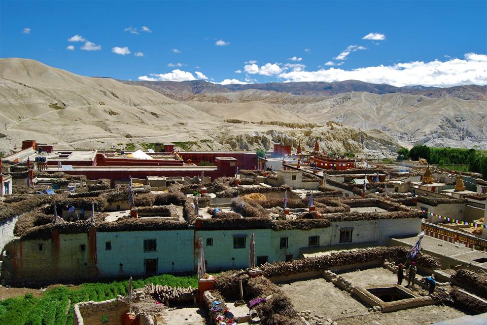
Upper Mustang refers to a region in the Mustang District of Nepal, which has a restricted area permit for tourists due to its unique cultural and environmental significance. The cost of visiting Upper Mustang can vary depending on various factors, such as the duration of the trip, mode of transportation, accommodation, and the services of a trekking agency, if you choose to hire one.
Upper Mustang was set at $500 per person for the first 10 days and an additional $50 per person per day for each day beyond the initial 10 days. These fees are subject to change, so it’s recommended to check with the relevant authorities or travel agencies for the most up-to-date information.
In addition to the permit fee, you would need to consider the cost of transportation to reach Upper Mustang, which usually involves a flight to Jomsom followed by a jeep or trekking from there. Accommodation and food costs can vary depending on your preferences and the level of comfort you seek. Hiring a guide and porters, if desired, would incur additional expenses.
It’s important to note that the cost of a trip to Upper Mustang can be higher compared to other trekking regions in Nepal due to the restricted area permit and the remoteness of the location. Prices can vary greatly based on the services you choose and the level of comfort you seek during your journey.
Itinerary:
Cost Include
Recent Post
- 7 Days Langtang Valley Trek -Cost, Itinerary & Difficulties 2026/2027
- Nar Phu Valley Trek – 7 Days | Remote Himalayan Adventure in Nepal
- Everest Base Camp Trek – 14 Days | Complete Guide, Itinerary & Adventure from Kathmandu
- Annapurna Circuit Trek Autumn (September–November)
- A GUIDE TO BEST PLACES TO VISIT IN JANUARY / FEBRUARY/ MARCH 2027 IN NEPAL
 Have Questions?